MotionBased Images

Topic Table of Contents

  1. MotionBased Images
  2. USNA to BWI via the B&A trail.
  3. Friday Night Sailboat Race
  4. Longish Ride In New Hampshire
  5. Practice Ride in Wakefield Park
  6. Down MD Route 2

MotionBased Images

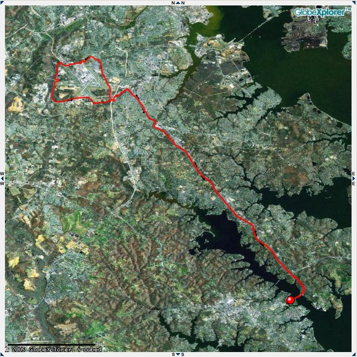
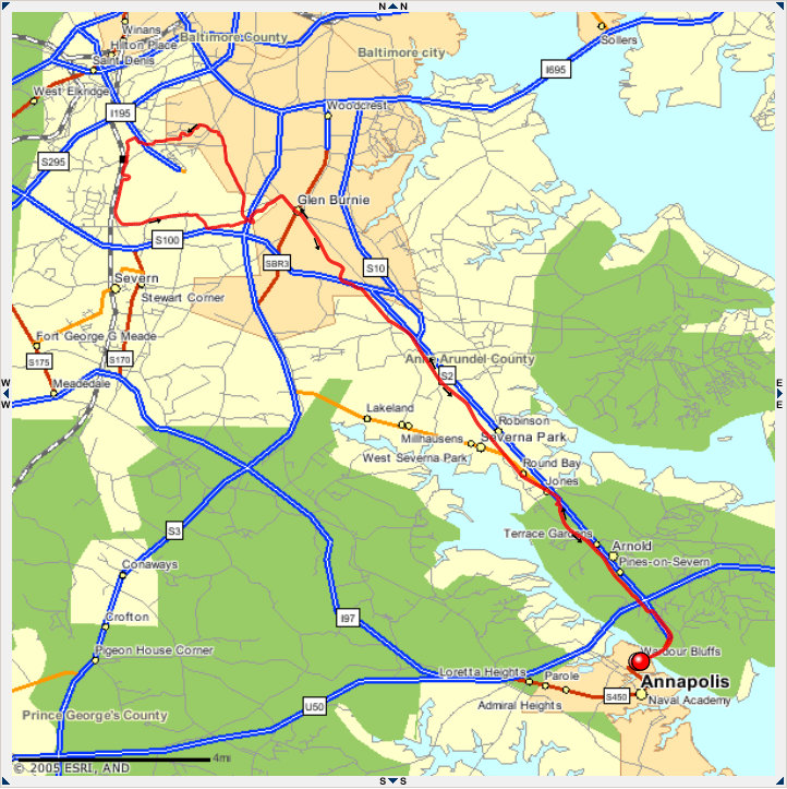
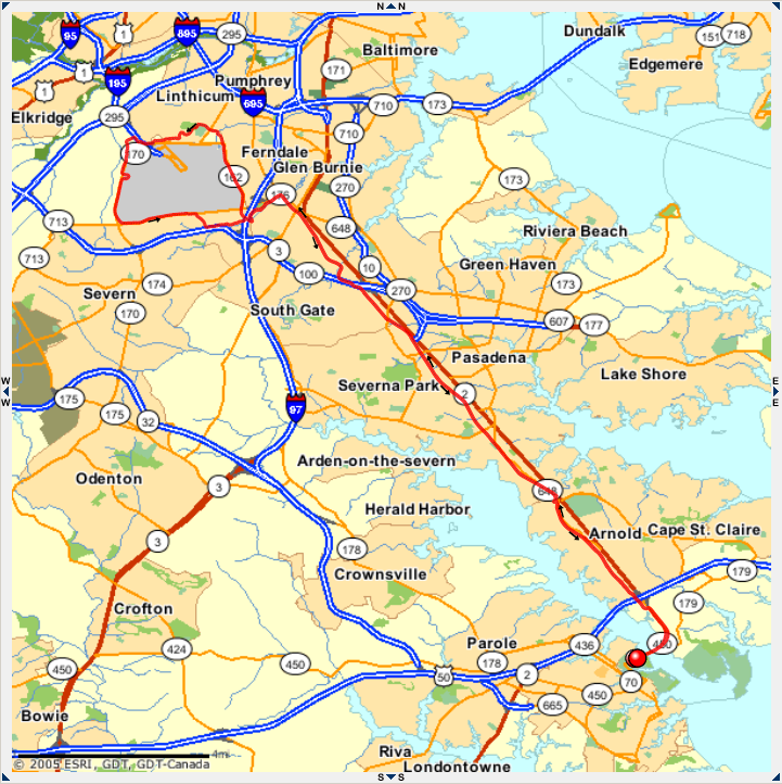
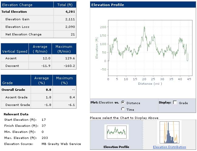
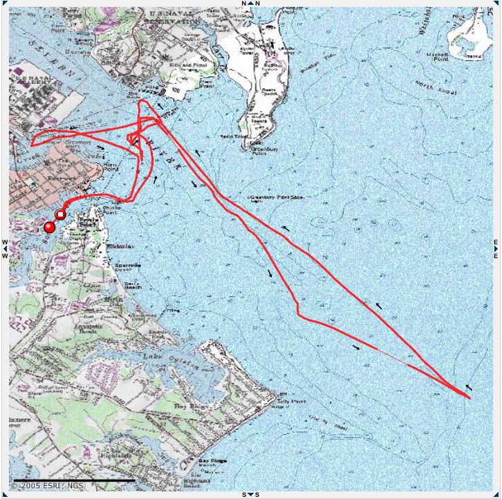
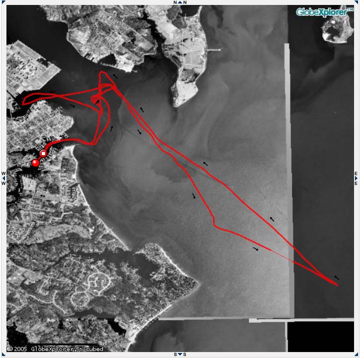
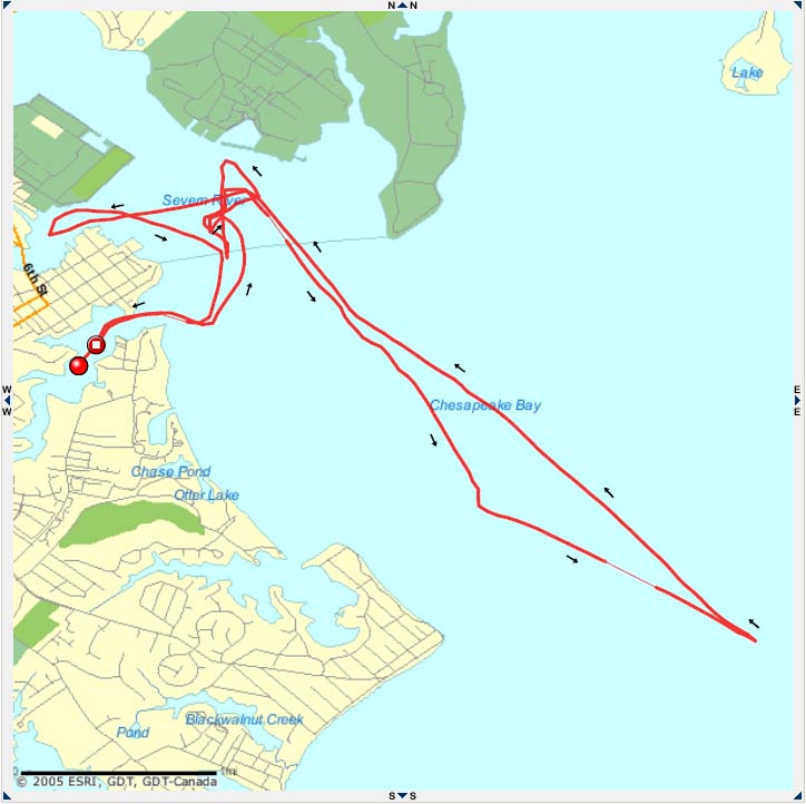
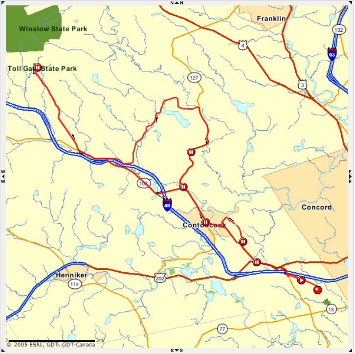
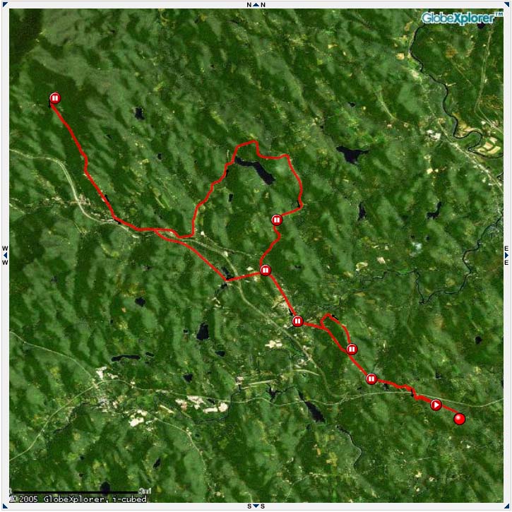
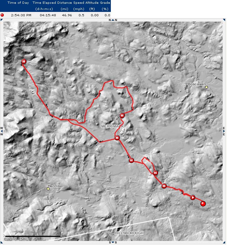
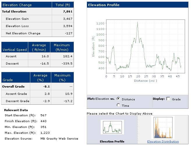
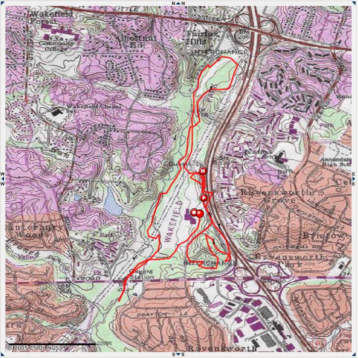
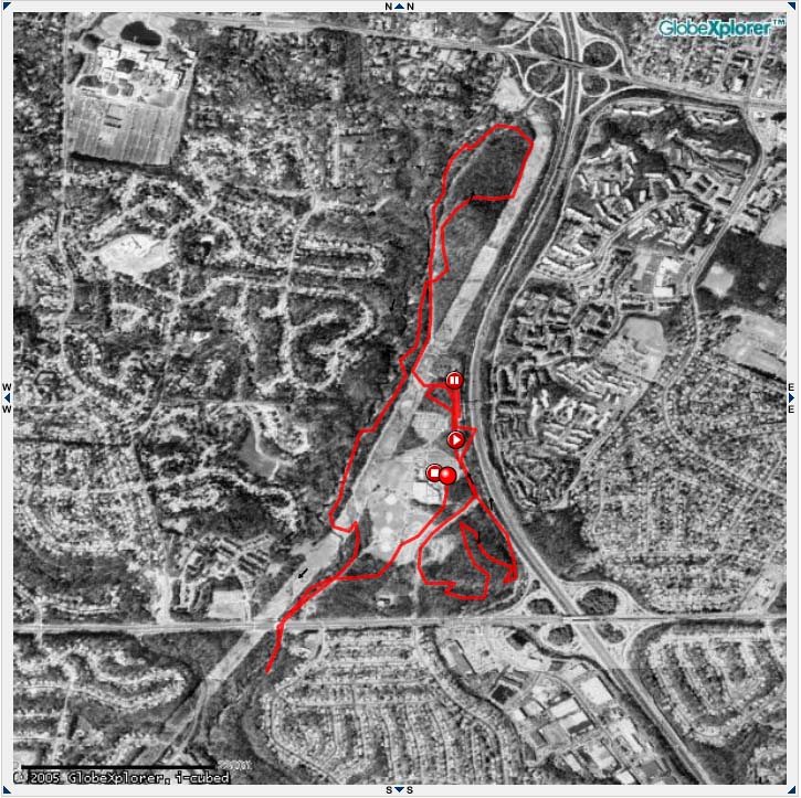
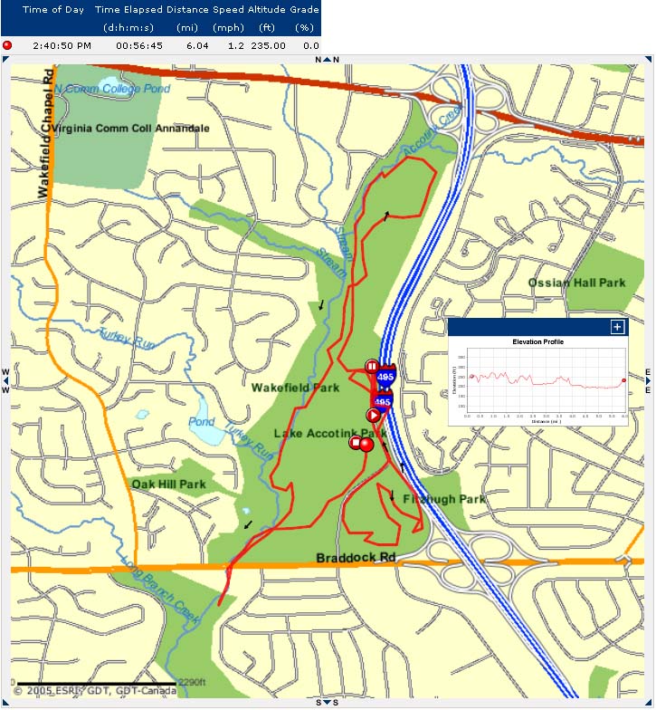
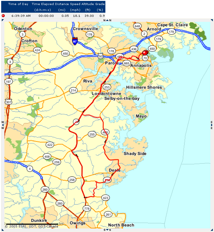
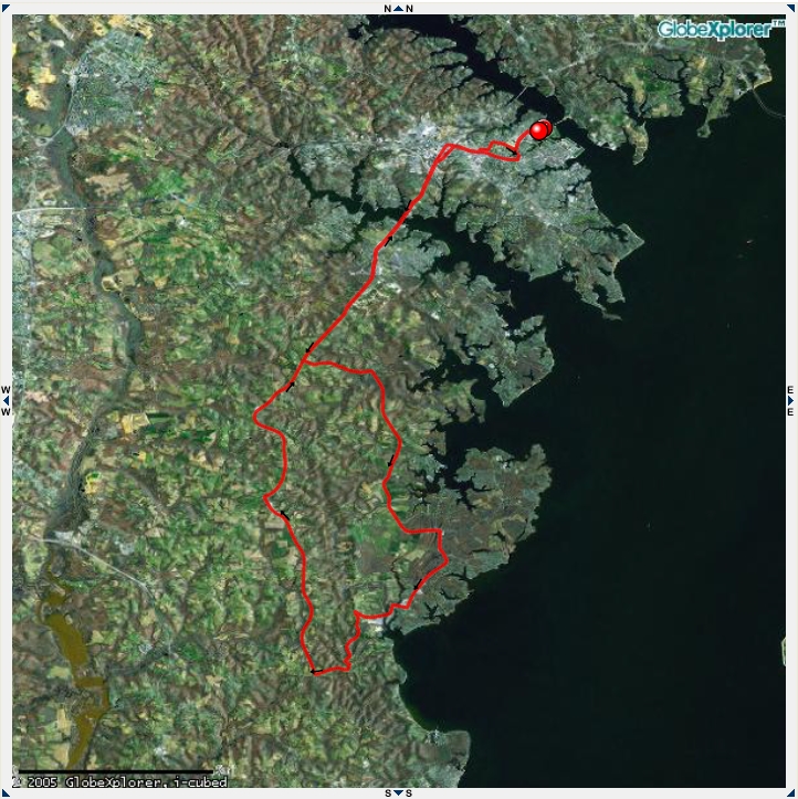
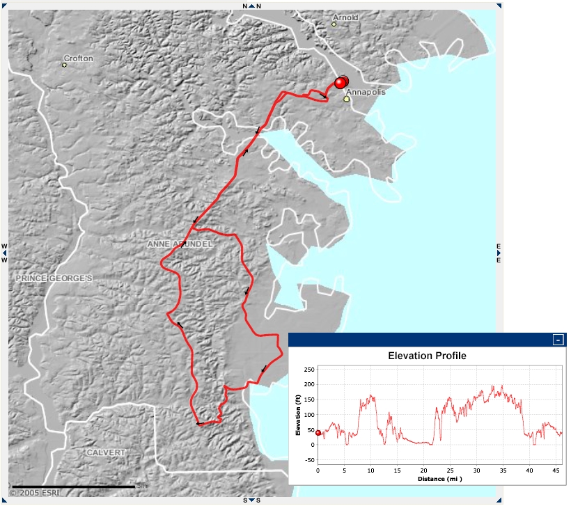
MotionBased.com is a very cool site that allows you to upload GPS track files, and display them superimposed on street maps, topo maps, and overhead imagery. It also allows you view speed and elevation profiles from your track files. Unfortunately my GPS unit does not store altitude data with its track files, so I can't generate elevation profiles.

The only downside is the images are generated as Adobe .svg files. This gives them a lot of cool features, but not a lot of software can read the .svg format.

I take screen shots of the images I like and save them as .png or .jpg files which are much easier to read.

USNA to BWI via the B&A trail.

These are images from the Naval Academy to BWI and back via the B&A trail. The bike odometer had the trip at 45.75 miles, The GPS said it was 44.5.

USNA to BWI via B&A (overhead image)

USNA to BWI via B&A (basemap) USNA to BWI via B&A (street map) Elevation Data

Friday Night Sailboat Race

This is our track on a Friday night sailboat race. It was really windy!!
Track on a Topo Map
Track on a Topo Map
Track on Arial Photos

Longish Ride In New Hampshire

This the route of a longish ride I did with Alex while his van was getting the side door fixed. We went from Hopkinton to Mt Kearsarge and back.
Route on Street Map
Route on Street Map
Route on Arial Photo Route on Elevation Map The elevation plot

Practice Ride in Wakefield Park

A practice ride on the mountain bike in Wakefield Park
The Route on the Topo Map
The Route on an Arial Photo The Route on a Street Map

Down MD Route 2

This was my first trip biking south on MD Route 2 from Annapolis. Once out of town it was very nice. GPX File