|
|
Bicycling
from Boston MA to Washington DC
|
|
This was our first long cycling trip. For those that are considering a cycling trip for the first time the lessons learned page covers what we discovered and our opinions of the equipment we used.
The complete trip photo album is also available.
Trip Summary
|
Date |
Starting Point |
Ending Point |
Today's |
Total |
Weather |
Alt. Modes of Transit |
Comments |
|
Wed, 2 Aug 00 |
Boston, MA |
Westerly, RI |
109.5 |
109.5 |
Rain in AM, Partly Cloudy PM, Temp: 70's |
None |
Rt. 102 in RI has lots of long hills |
|
Thr, 3 Aug 00 |
Westerly, RI |
Fisher's Island, NY |
35.5 |
145.0 |
Cloudy AM, Partly Cloudy PM, Temp 70's |
Fisher's Island Ferry |
Visited Stonington CT |
|
Fri, 4 Aug 00 |
Fisher's Island, NY |
Fisher's Island, NY |
0.0 |
145.0 |
Sunny AM & PM, Temp 80's |
None |
A day of rest and reading |
|
Sat, 5 Aug 00 |
Fisher's Island, NY |
New Rochelle, NY |
81.8 |
226.8 |
Sunny AM & PM, Temp 80's |
Fisher's Island &
Orient Pt Ferry |
Long Island is flat until Port Jefferson. |
|
Sun, 6 Aug 00 |
New Rochelle, NY |
New Rochelle, NY |
3.0 |
229.8 |
Cloudy AM, Drizzle PM, Temp 70's |
None |
got bikes at dock and a day of rest |
|
Mon, 7 Aug 00 |
New Rochelle, NY |
Princeton, NJ |
87.7 |
317.5 |
Sunny AM, Rain and Thunder PM |
Staten Island Ferry; Port Authority Van at Gothell's Bridge |
Manhattan is exciting on a bike and the Gothell's Bridge is closed to bike traffic |
|
Tue, 8 Aug 00 |
Princeton, NJ |
Atlantic City, NJ |
92.3 |
409.8 |
Sunny AM & PM, Temp 90's |
None |
Middle of NJ is flat and empty. |
|
Wed, 9 Aug 00 |
Atlantic City, NJ |
Greenville, DE |
85.8 |
495.6 |
Sunny AM & PM, Temp 90's |
Cape May-Lewes Ferry |
DE is flat with wide shoulders. |
|
Thu, 10 Aug 00 |
Greenville, DE |
Washington DC |
93.7 |
589.3 |
Cloudy AM, Sunny PM, Temp 90's |
Taxi across Bay Bridge |
Roger broke his rear axle in three pieces. |
The Trip Photography
The photography on the trip was done with a Yashika T-4 with Fuji Chrome Velvia slide film. The good slides were then put onto Kodak PhotoCD and posted in my (Roger's) photo portfolio on www.photo.net. Thumbnail images of these images (leading to the higher resolution images on photo.net) are posted here. To carry the camera, I threaded the leather camera case on to one of the straps on my Camelback. This allowed the camera to rest just behind my shoulder. It was out of the way and easy to reach. This mounting method was great except for two drawbacks. 1) By the last day the leather case was about to fall apart. 2) Since the shoulder strap of the Camelback was passed through the loop on the camera case, the case could ride up about. Especially if you spent a lot of time peddling standing up then the case would have a tendency to bounce over the top of your shoulder. One the last day I traveled with the camera in the back pocket of my cycling jersey. This also worked well, but usually I carried the map here.
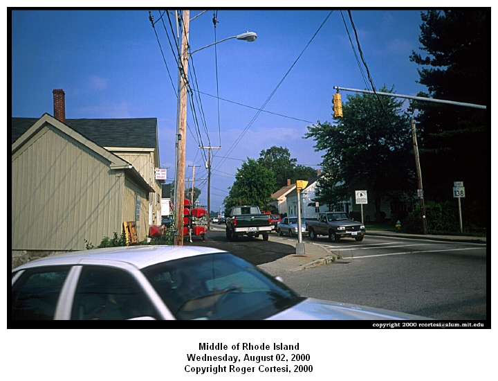
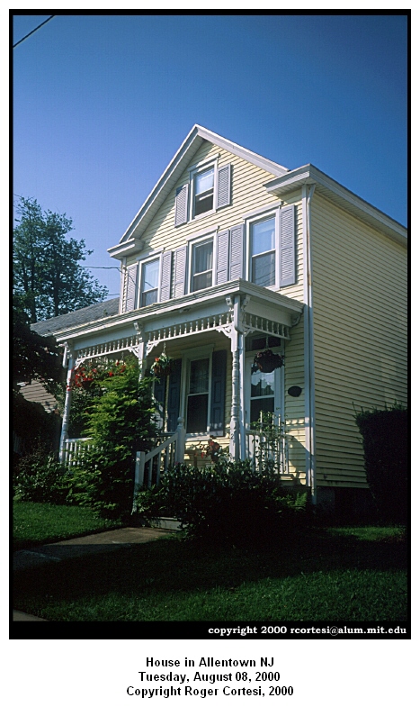
Day 1, Wednesday August 2nd 2000: Boston MA to Westerly RI
Route Maps: Boston MA to Woonsocket RI, Woonsocket RI to Westerly RI
|
Distance Traveled 109.45 miles Time moving: 9h 56m Well the trip got off to a fine start. Roger left the maps that we had so painstakingly made with the Microsoft Streets & Trips in the car. This was deemed not a huge problem since we had a good bike maps of Massachusetts and Rhode Island. The stretch in Connecticut is just down Rt. 1 to New London and part in Long Island is pretty easy too. So we decided to push on without the maps we had made. |
|
The Route:
We started by wandering in downtown Boston to Tremont St, to Washington St (through Roxbury) to Hyde Park Ave, to Neponset Valley Parkway, to Rt. 138 (past blue hills) to Washington St (Through the town of Canton) to Rt. 27N, to Washington St (through the town of Walpole), to Summer St (at South Walpole), to Route 140 (in Wrentham). We took Route 140N (through the town of Franklin, to King St, to Forest St, to West, to Spring St (and crossed in to RI). We took Route 114 (though Woonsocket and Blackstone MA), St. Paul St, to Route 146A, to 102. We took 102 to Route 3, and Route 3 into Westerly. After Route 7, 102 is pretty much up and down the whole way to Route 3.
Comments on the Route:
The nicest parts of this section were going through Walpole to Wrentham. The 2 lane road had basically no traffic, and lots of woods and nice houses. There were some farms mixed in. We saw, and mooed at, some cows, and barked at some dogs.
For the most part the grades today were ok. The hilliest section was RI Rt. 102 which had lots of very long hills. There is a very wide shoulder for most of the southern part of 102 and very light traffic. Route 3 also has a wide shoulder with light to moderate traffic. The only exception seems to be in the area around Hope Valley RI. Here there is no shoulder and the cars would scream by.
We stopped for breakfast at a Mobil station in Walpole just before Washington St. breakfast was PB&J. Roger’s rear derailer was shifting the chain off the gears, so he adjusted the travel stops at breakfast. It no longer went into the highest gear, and it takes about 3 clicks to change the next gear.
|
We crossed into Rhode Island after traveling 44 miles and pedaling for 3h35m, on Spring St. We stopped for lunch of bananas, granola bars, and oranges at Route 102 and 7. We stopped for more PB&J and a much needed break at the West Greenwich police station on 102. We wondered around Westerly for a while looking for a motel. Asked a guy at the Mobil station just inside CT. His directions were not very helpful. We went up the road to the fire station and asked. We were directed about a mile up Rt. 1. There was one last big hill climb to get to the section of 1 that we needed. RI getting its last shot in now because tomorrow it is off to Connecticut. We arrived at the Franklin Gardens motel on Route 1 (north of Westerly center) at about 7:35pm and then went and ate supper at the Friendly’s across the street. Roger was disappointed to find that Friendly’s does not serve beer. But he made due with a tasty strawberry milkshake. |
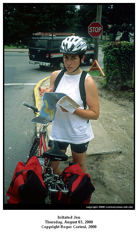
Day 2, Thursday August 3rd 2000: Westerly RI to Fisher's Island NY
Route Maps: Westerly RI to North Port NY
|
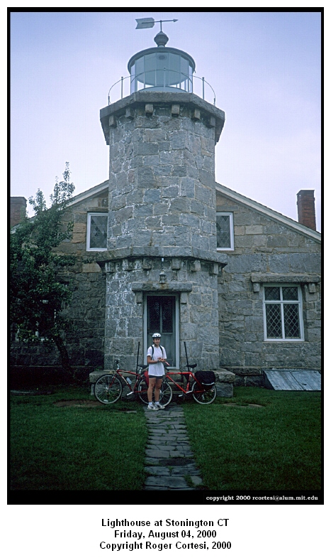
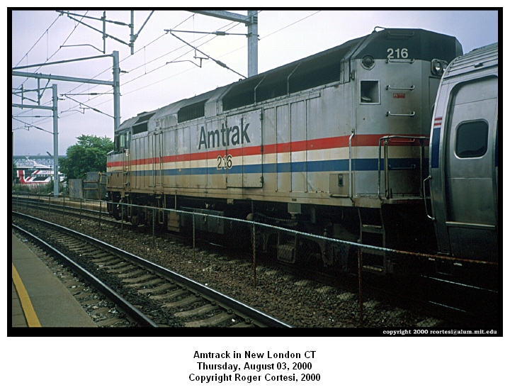
Distance Traveled 35.5 miles We slept in until 7:30!! When we left it was raining steadily. The temperature was pretty warm (low 70's maybe). The Route: We took Rt. 1 south to Stonington CT, then took Rt. 1A into Stonington village. We took a detour down Water St to see Roger’s grandmother's old house. We continued on to the point at the end of Water St. After this break we continued west on 1a until it met back up with Rt. 1. We followed this into Mystic. We crossed the Mystic River on the drawbridge. We continued south on Rt. 1, and took 215 back to Rt. 1 west into Groton. We took the pedestrian walkway on the I-95 bridge across the Thames and a one the other side made our way to the New London train station. |
|
Comments on the Route:
Our earlier concerns that Rt. 1 south of Westerly might have a lot of lights and not be too pleasant were unfounded. There was a wide shoulder.
Right before rejoining 1 west there was very large hill in the town of Groton. Rt. 1 in Groton becomes a bunch of strip malls and stores. Before this happens we did pass a few bicycle shops. Rt. 1 during and after the stripmall section is not great biking. There is no shoulder, and the two lanes in your direction are 1) very narrow and 2) filled with lots of high speed traffic.
There is a bike and pedestrian walkway on the I-95 bridge over the Thames River. There are lots of white signs instructing bicycles and pedestrians to use it. However, on the Groton side we did not see any signs telling us how to get there. Our first attempt to find it, lead us up the entrance ramp to 95. This is left side entrance, so to get the shoulder where the walkway is would have required crossing 4+ lanes of high speed interstate traffic. Not having a death wish in particular we turned around. We decided to eat lunch at the IHOP on Rt. 12 before attempting another crossing of the themes. Lunch was great. I had been trying get around to get to an IHOP for about the past two months.
After lunch we continued up Rt. 12. The thought being that if we could get around and look at the underside of the 95 bridge maybe we could see where the walkway went. We took Walker Hill Rd to groove street to Fairriver Ave. As we were passing under the bridge on Fairriver Ave we found a mailman who directed us to the start of the walkway. The walkway started on Bridge street.
A few miles west of westerly on Rt. 1 we did pass several motels (none were within walking distances of Friendly’s though)
Looking upriver while crossing the draw bridge into Mystic, we could see the tall ships at Mystic Seaport. We were strong and fought the temptation to eat at any of the several ice cream shops we passed (most of them being closed at 9:30 am helped some too).
|
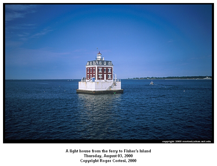
The trip across the bridge was rather uneventful. On the other side we made our way to the New London train station to meet Roger’s parents' train. They arrived on time. The 4 of us took the 3:30 ferry to Fisher's Island.. While we were waiting to depart a submarine passed us on its way out to sea. The ferry ride was rather uneventful. |
Day 3, Friday August 4th 2000: Fisher's Island NY to Fisher's Island NY
|
The bikes did not leave the garage. We spent the day reading and relaxing on Fisher's Island. We went for a walk around part of the island. There is one huge ass golf course here. Took some photos, and barked at a dog. |
|
Day 4, Saturday August 5th 2000: Fisher's Island to New Rochelle NY
Route Maps: Westerly RI to North Port NY, Northport NY to New Rochelle NY
|
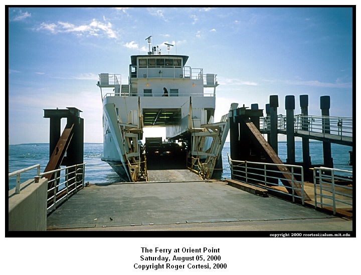
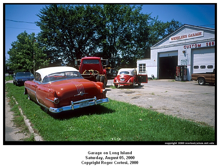
Distance Traveled: 81.8 miles Time Moving: 7h 36m The Route: We started by biking about 8 miles to the ferry which we took back to New London, CT (8:15-9:00am). This stop was only temporary since an hour later, we were back on another ferry. This time we were headed to Orient Pt, Long Island, NY (10-11:25am). We arrived at Orient Point at about 11:30 am at the very start of NY Rt. 25 West. It was pretty flat with a good shoulder for the first few hours. We chose to take the Rt. 25 truck route which is also Suffolk County Rt. 48 rather than staying on Rt. 25. This connected to Rt. 25A at Wading River. We took this all the way to Main St in Northport which we took down to the water to meet Jen’s parents on their boat. |
|
Rt. 48 gets pretty narrow and loses the shoulder for a big chunk of distance, however. In addition, this road stays closer to the coast as it travels through Long Island Wine Country. Unfortunately, we did not get a change to stop for any samples. We rode for hours through the countryside with a rest-stop every few hours. At Wading River, Sound Ave (which connects Rt. 48 with 25A) finally merges into 25A so we knew that we were still in the right spot. Though we were traveling on flat or very gradually upward sloping terrain, right before Port Jeff there was a huge downhill. |
|
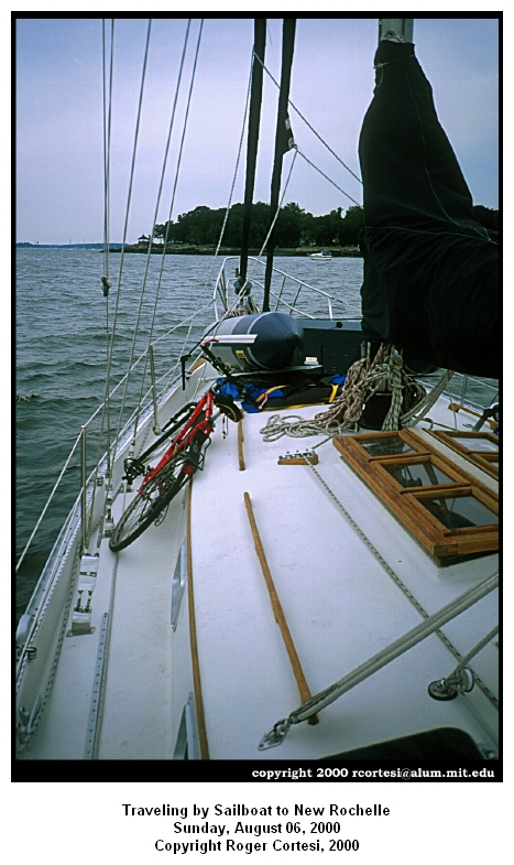
This is only a mean trick, however, because after this point the rather large up and downs began and stayed with us for the remainder of the trip to Northport. In Port Jeff, we were starting to wonder how much farther Huntington was (still our destination for the day at this time) and we got several estimates including a guy working in a bike store: "Dude! That's really far, like 50 miles or something!" In turns out that it was closer to 20. Luckily, our final approach into Northport on Main St was a wonderfully steep and long downhill. If it had been up, Jen probably would have shot someone, namely, the first family member she encountered. We loaded the bikes onto the sailboat while resisting the swarms of bugs on the dock and departed at about 8:15pm. The swarms of bugs are just one indication that there was no wind at this time, so we had to motor from Huntington Bay all the way back to Larchmont Harbor in the dark. This took quite a while so we did not reach New Rochelle until 1 am. |
|
Day 5, Sunday August 6th 2000: New Rochelle NY to New Rochelle NY
|
Distance Traveled: 3.0 miles Time Moving: approx. 20 m We drove back to Larchmont Yacht Club to get the bikes off the sailboat and biked back to Jen’s house in New Rochelle. It was rather hilly, but they are short and for only 3 miles, almost anything is manageable. It was cloudy and a little drizzly today, so a good day for laundry and sitting around. |
Day 6, Monday August 7th 2000: New Rochelle NY to Princeton NJ
Route Maps: New Rochelle NY to Manhattan NY, Manhattan NY to New Brunswick NJ (via Staten Island NY), New Brunswick NJ to Princeton NJ
|
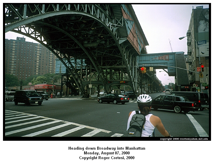
Distance Traveled: 87.66 miles Time moving: 8h 53m We said goodbye to Jen's parents and started pedaling in New Rochelle at about 6:40 am. Forest Ave, North Ave, Lincoln Ave., to Mt. Vernon Ave, Yonkers Ave. to Kimball Ave, to McLean Ave, around Van Cortland Park to Broadway (Rt. 9A) where we entered the Bronx. There are a lot of hills in Yonkers. |
|
|
|
Once in the Bronx we started battling the traffic in earnest. Broadway took us all the way through the Bronx. We passed the bar that Jen frequented in high school, but the bar had been renamed! They probably card now. The traffic was a lot lighter then expected for a Monday morning. The car, trucks, busses, and street sweepers were all polite. Since it was a street sweeping day there were a lot of parking lanes clear for us to pedal in. For a while in the Bronx we were riding under the elevated trains. We crossed the Broadway Bridge over the Hudson River. On the far side of the bridge there was a sign saying no bicycles allowed. Great placement, guys. On to Manhattan: We continued down Broadway, with fairly light traffic, until about 180th street when it started getting heavier (still giving us plenty of room though). We turned off Broadway at 120th and got on Riverside Drive. We went on the drive for about 10 blocks and then got on a bike path in the park. After cycling for a little bit we stopped for breakfast at a playground. |

|
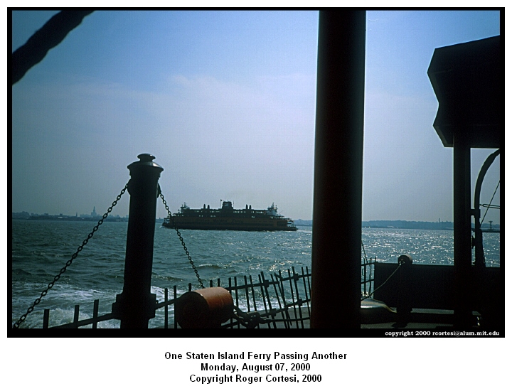
The path in the park ended in the 70's. We made our way over to 11th Ave., which we took to Chelsea Pier. We then tried to go across to 5th Ave but ended up on Mercer Street (cobble stones and very narrow with lots of delivery trucks), which we took to Canal Street. Traffic was really starting to get heavy in the financial district. After this our exact route is a little vague as we just followed signs to the Staten Island Ferry. We had a 15-20 minute wait for the ferry. We boarded it on the upper pedestrian entrance. A policeman directed us to the vehicle deck downstairs. In the future use the vehicle entrance when boarding with a bicycle. The ferry was free and the ride lasted about 25 minutes. |
|
|
Once on Staten Island we made a right on to Richmond Terrace and just followed signs for the Goethals Bridge. When we arrive at the NY/NJ Port Authority building, Roger went upstairs to ask about how bicycles could get across. "They can't cross this bridge". The only bridge off Staten Island that bicycles can ride over is the Bayonne Bridge. Hmm that would take us in the opposite direction from Princeton, NJ. None of the city buses run across the bridge. We tried calling three taxi companies. The first said no and hung up on us, and the other two numbers did not work. A taxi pulled up to drive this other guy across the bridge. Roger asked the driver if knew of a taxi company that would take us across. He thought Sam's Taxi in Staten Island would do it. At this point a really nice man named Manny Ortega (we may be messing up the name), who works for the port authority, called up one of his coworkers. The coworker picked us up in a bright yellow van and dropped us off on Rt. 1 &9 near Linden, NJ. |
|
Multiple people had advised us that Rt. 1&9 in NJ is horrible for biking. It is clear why. There are about 3 lanes in each direction, no shoulder, and the traffic is extremely heavy. The speed limit is 55 mph, but the traffic of mostly 18-wheelers was at a standstill. We turned off this road at the first available side road, Clinton Street. From here we turned on another side road (left) that went past school #6 and ended up on Rt. 617. We took Rt. 617 to Rt. 514, which merged into Rt. 27 outside New Brunswick. There were a lot of trucks on Rt. 514 but there was an adequate shoulder for most of it. Several miles outside of New Brunswick, Rt. 514 became a much larger 4-lane highway with a lot of debris on the shoulder. We were looking for Rt. 514 leaving New Brunswick. |
|
|
According to the map, Rt. 514 should have branched off Rt. 27, but first we looked up Rt. 27 for a ways and didn't find it then we went over to Rt. 527 and didn't find it there either. This part of the map was not clear - the critical intersection was blocked by the "ck' in New Brunswick. Rt. 527 was good, however, in the beginning and you could see the river on the right. Rt. 527 soon got a lot busier so we got on a crappy bike path that ran next to it to get us out of traffic. |
|
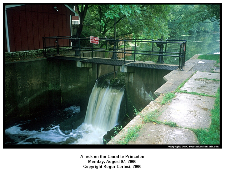
We took Rt. 527 to just before I-287. We stopped at the Kwikimart at Cedar Grove Lane to get a more detailed map of Mercer County and directions to the Delaware and Raritan Canal Path. We took Cedar Grove Lane to Weston St, and we wound around a lot, following little bikes painted on the road. We ended up in Colonial Park on the canal. Our intention was to follow the canal path all the way into Princeton. We started off on a paved path in the park that ran near the canal and then it ended at Elizabeth Road. This took us back to Rt. 514. We went west on Rt. 514 and picked up the canal again in East Millstone. Here, we started on the dirt towpath along the canal. It had been raining since we got on Rt. 514 for the second time. We followed the towpath to Black Mills and crossed the canal to try riding on Canal Road. |
|
|
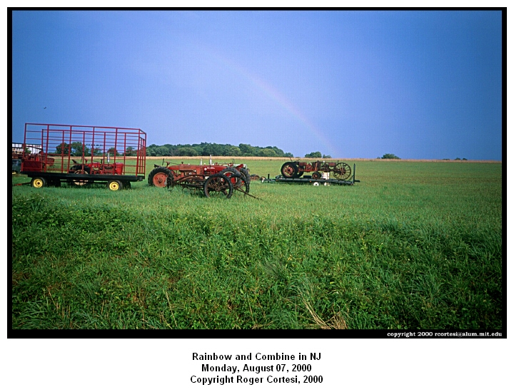
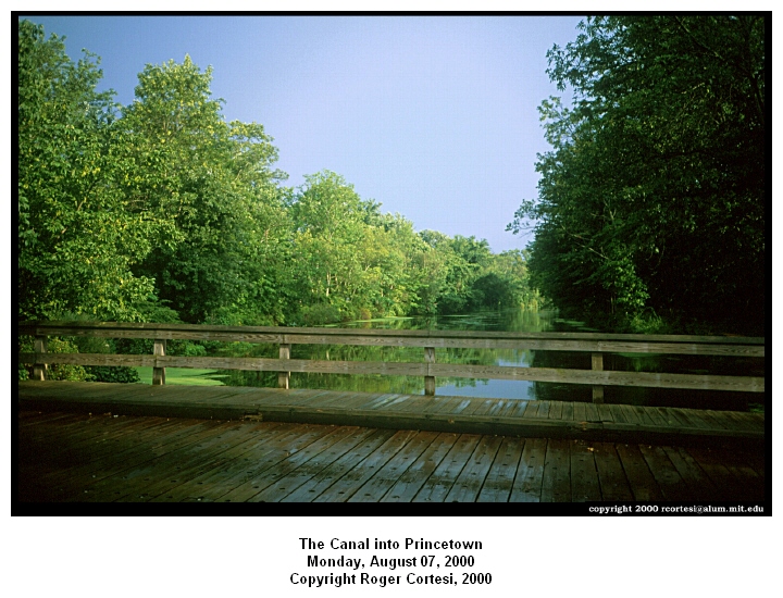
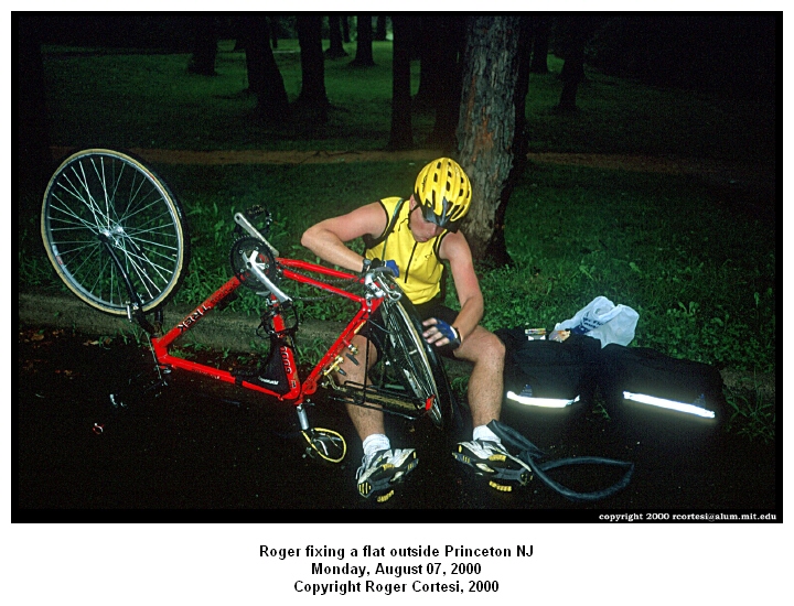
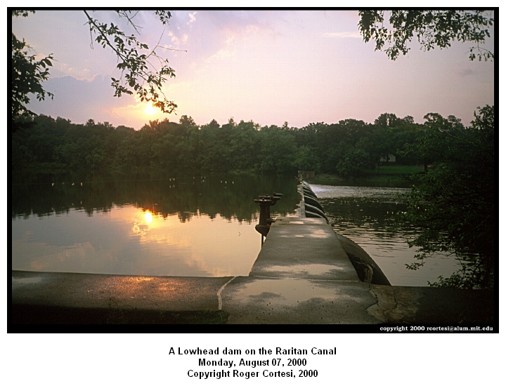
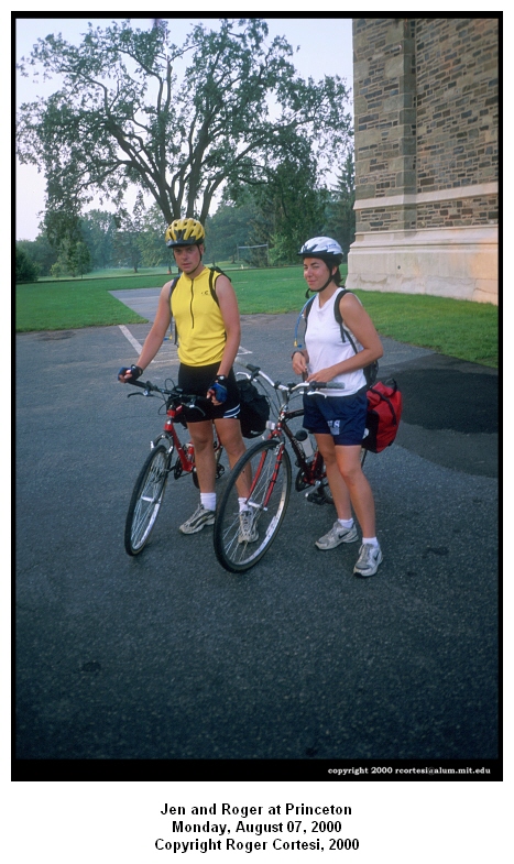
This was much less dirty then the path and would have been very nice, but there was no shoulder and a the little traffic that there was would go screaming past us at about mach 2. We saw a triple rainbow behind us when the rain stopped. We got back on the path the Griggstown lock since it was more direct and there were no cars. By this point the sun had come out, and we were making good time, though getting pretty dirty in the process because of all the mud puddles. Roger got a flat where the towpath crosses Rt. 27 so we fixed it there. That provided a much-needed break. We continued the 5.5 miles to Alexander Street in Princeton. We went to my friend’s old house but he had moved and neglected to tell me his new address! Fortunately, a friend of his had moved in and she gave us direction to Tommy's new apartment on the Princeton campus. Once there, we rinsed the bikes off, did laundry, had really good Chinese food, and went to bed. |
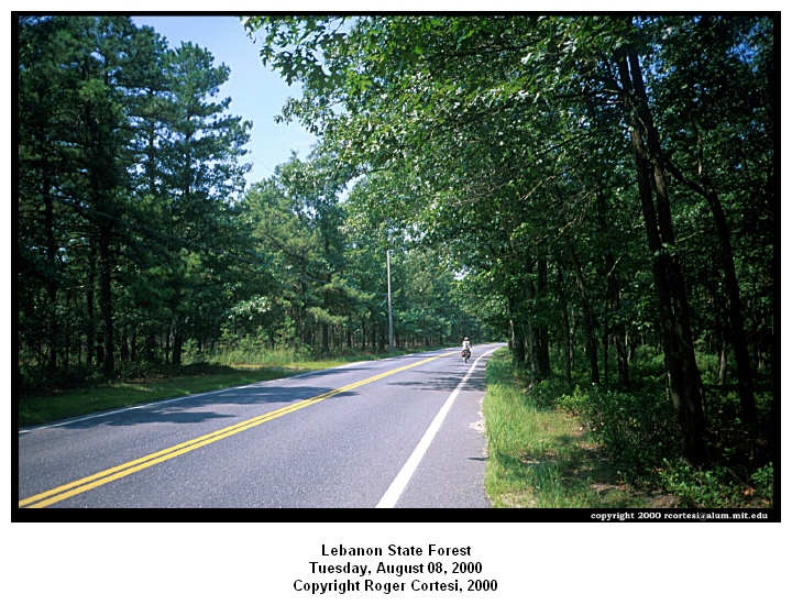
Day 7, Tuesday August 8th 2000: Princeton NJ to Atlantic City NJ
Route Maps: Princeton NJ to Lebanon State Forest NJ, Lebanon SF NJ to Egg Harbor NJ, Egg Harbor NJ to Atlantic City NJ
|
Distance Traveled: 94.28 miles Time moving: 7h 35m So we finally left Princeton at about 6:40am. The weather was clear, but a bit warm and humid. We took Alexander Road, to North Post Road, turned left onto something that begins with a c, right onto Glaston Rd then right onto Old Trenton Rd. We took Rt. 526 to S. Main Street and then turned left onto Rt. 539. We saw a bit of the morning traffic, but nothing very heavy in our direction. We took Rt. 539 and at the junction with Rt. 528 we stopped at a bike shop to get a replacement inner tube and some chain oil. The drive trains on both bikes were feeling and sounding a bit tortured from the previous day’s adventure in the mud. The people at the shop were very helpful and suggested a good route to Atlantic City. |
|
|
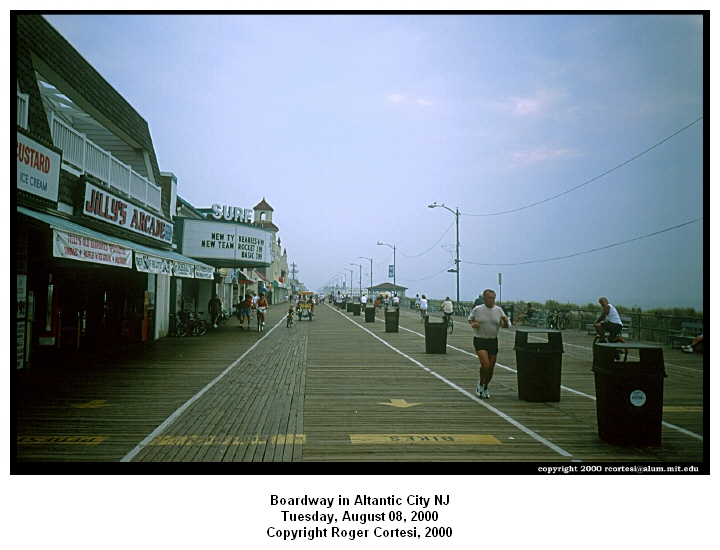
It was about 10 miles from the bike shop to Rt. 70. About 2 miles past Rt. 70 we crossed some old train tracks and then made the next right on Pasadena Rd (the small green street sign called in something else). Rt. 539 had a good shoulder and moderate traffic with a lot of trucks. Pasadena Rd went from some shoulder to none, but there was almost no traffic. In the 8.5 miles to Rt. 72 we were passed by about a dozen cars. The Pine forests are on both sides of the road are very nice. There had not been any major hills yet today. The ground rolls up and down very slightly and we have been making excellent time.We turned left onto Rt. 72 and then right onto Rt. 532. We took this to Rt. 563 in Chatsworth. We stopped for lunch here having traveled 52 miles in the morning. In Chatsworth we took Rt. 563 South into Egg Harbor. Rt. 563 was a pleasant cycle. Traffic was light. Then we took Rt. 30 all the way into Atlantic City. Traffic on Rt. 30 was heavy, but there was a wide shoulder for most of the way. |
|
We arrived in Atlantic City at 5:30 PM. Once there we took Martin Luther King Blvd to the Boardwalk. We walked up the Boardwalk with the bikes a little bit until we found a Comfort Inn on Kentucky Ave. We got a room and then went out on the Boardwalk to find something to eat and to look at the strange people. |
|
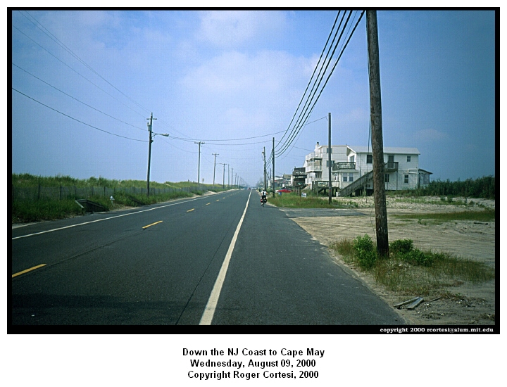
Day 8, Wednesday August 9th 2000: Atlantic City NJ to Greenwood DE
Route Maps: Atlantic City NJ to Sea Isle City NJ, Sea Isle City to Greenwood DE
|
Total distance traveled today: 85.8 miles Total time moving: 7h 37m Atlantic City to Cape May Distance: 52 miles Time: 4h 45m Total distance traveled to date: 498.44 miles The weather was overcast in the morning and then sunny by midday. It warmed up after 10 am so the temperature was in the 80's. After our continental breakfast of Rice Crispies, Cheerios, Orange Juice and bananas we started out. |
|
|
We traveled down the Atlantic City boardwalk for the first 4.5 miles, then we took Atlantic Ave and eventually cut over to Ventor Ave to the traffic circle. We went over our first bridge of the day. After this bridge we had to take a more indirect route to Ocean City. We took Rt.152 inland since the more direct bridge is closed to bicycles. We took Rt. 152 to Rt. 585, which then became Rt. 52. We took this across another bridge back towards Ocean City and the boardwalk there. This was superior to the Atlantic City Boardwalk because it had designated bike, surrey, and pedestrian lanes for each direction. This lasted about 1.2 miles and then the boardwalk narrowed so we took Central Ave south. Later on we tried getting back on the boardwalk because it pretty very empty, but it ended 1 block later. |
|
Back on Central Ave we took Ocean Drive (Rt. 619) until North Wildwood where it became Rt. 621. Follow the gull signs. We crossed a whole bunch of cool draw bridges over the intracoastal waterway. It was $0.50 for cars and free for bikes!!!! The bridges had a metal grating for the draw part. We stopped to eat our regular fare of peanut butter, bananas, bagels and granola bars outside the McDonalds in North Wildwood (where 619 became 621). At Rt. 109, Roger made a wrong turn south (following signs to cape may), and we had to ask for directions to the ferry. There is no sign for the ferry at the junction of Routes 109 and 621, but there were lots of signs to lead the beach traffic from the beach back to the ferry.
|
|

|
We turned around and made our way to the ferry. We caught the 1:40 PM boat to Lewes. The ferry ride was about 1h 20m and the cost for two cyclist was $14. After leaving the ferry port at Lewes, DE we stopped in the main terminal building and picked up our free map of DE, and a booklet with all the motels and hotels in Delaware listed. This was very useful, as it was one of the factors in determining how far we could go that afternoon. We took Rt. 9 to Rt. 5. For about 1/2 mile Rt. 9 and 1 are the same with 3 lanes of moderate to heavy traffic in each direction. We took Rt. 5 North into the town of Milford where we picked up Rt. 16 West. We stayed on Rt. 16 until the junction with Rt. 13 N (about 14 miles). We turned north for about 1 MI on Rt. 13 to the Greenwood Inn, passing Cafe Milano, the Italian restaurant we would return to for dinner an hour later. |
We don't know why someone would choose to visit Greenwood, however . . . maybe it's for the truckers passing through. There was a billboard advertising a Hampton Inn about 10 miles south of the Rt. 16/13 junction that would be opening in the fall of 2000, so if passing through again, it might be worth looking into.
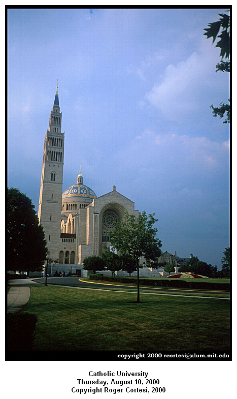
Day 9, Thursday August 10th 2000: Greenwood DE to Washington DC
Route Maps: Greenwood DE to Annapolis MD, Annapolis MD to Washington DC
Distance traveled: 93.7 miles Time moving: 8h 27m
We left the motel at about 6:30 am since it was still dark at our earlier (planned) departure time. DE continued to be very bicycle friendly. We took Rt. 16W until it split from Rt. 404W right before Denton where we stayed on 404W. We stopped at Food City while there was a brief shower to get more granola bars, peanut butter, bagels, and Gatorade.
We passed through Denton, and continued on Rt. 404W. A section of it was really big after Denton, but shortly afterwards it settled down again. The shoulder continued to be very wide and there were lots of "share the road signs". Just before Wye Mills we got on Rt. 50. Traffic was heavy and fast, but there was a very large shoulder so it was not a problem. We stayed on Rt. 50 for about 8 miles and then took Rt.18 West. Rt. 18 West was 2 lanes, residential, with light traffic, but no shoulder. We passed though the town of Grasonville. Then we came to the Kent Narrows Bridge. Route 50 takes a large overpass over the narrows while Rt.18 crosses on a small drawbridge, with a wide smooth red bike path next to it.
|
We continued up Rt. 18 west until well got to Rt. 8. Here we stopped in the "Shore Stop" convenience store & gas station to call the taxi that would take us across the Bay bridge. Since we had failed to give the taxi company any advanced warning, we had to put the bikes in the back of a station wagon. With a little warning (the day before) they could have picked us up in a pickup truck, which would have been easier. After getting driven across the bridge we were dropped off along the Rt. 50 service road in the parking lot of a "Beer Wine Spirits" store. We kept pedaling until Roger noticed a new wobble in the rear wheel of his bike and a dramatic increase in the effort needed to keep it moving. We stopped again and I ascertained that the problem was a broken rear axle. After some tinkering and adjusting of the rear cones and quick release lever, I was able to get the bike to roll reasonably well. This allowed us to make it into Annapolis. |
|
|
After making our way to Main St, we asked a UPS man if there were any bike stores in the area. He sent us to a street just off Rt. 450 W (West St.), which was great since it was close by and it was in the right direction. The guys there seemed to be amazed that Roger's rear axle was in such bad shape. We spent about an hour there getting it fixed and finally continued on. We stayed on Rt. 450W through Bowie (and up and down lots of hills) until a “T” intersection. Then we got on Rt. 564, which crossed the Beltway in New Carrollton, MD. Then we took Riverdale Rd., which becomes Rt. 410 (still pretty big hills) and made a left onto Queen Chapel's Rd., which became Michigan Ave. when we entered DC. We took Michigan Ave around the Washington Hospital Center (at this point we are riding in the sidewalk which indicates that it is the Bike Route since traffic was getting heavy and there was NO shoulder at all on the street). We turned onto Columbia which took us to Kalorama and eventually winded our way to Massachusetts Ave and our final destination! All this and it was only 6:55 PM rather than the much later expected arrival time when we initially estimated that it was over 100 miles from Greenwood, DE to Washington, DC. |
Route Map Index (North to South)
- Boston MA to Woonsocket RI
- Woonsocket RI to Westerly RI
- Westerly RI to Northport NY
- Larchmont NY to Manhattan NY
- Manhattan NY to New Brunswick NJ (via Staten Island NY)
- New Brunswick NJ to Princeton NJ
- Princeton NJ to Lebanon State Forest NJ
- Lebanon SF NJ to Egg Harbor NJ
- Egg Harbor NJ to Sea Isle City NJ
- Sea Isle City to Greenwood DE
- Greenwood DE to Annapolis MD
- Annapolis MD to Washington DC
Useful Links and Contact Information
Cycling Touring Links
- The Touring Section of Ken Kifer's Bike Pages: This is an excellent biking web site with links to lots of travellogs and other good information.
- The Deja.com index of bicycle forums on usenet: Another good sorce of information and personal experiances
- Mike Vermeulen bicycle touring web site: We used his travellog extensively in planning our trip.
- http://www.bikeaccess.net/ Has good information about travelling with your or shipping your bike.
Transportation Links that we used to get ferrys etc. on our trip.
- New London to Fisher’s Island: (860) 442-0165 http://www.benkard.com/ferry/ $7 per person and $10 per bike. 3 or 4 trips per day .
- New London to Orient Point: (860) 443-5281 http://www.longislandferry.com/ $12 per person with bike departs hourly, enroute time 1h20m
- Port Jefferson to Bridgeport CT: http://www.bpjferry.com/ $14.25 per person with a bike, departs hourly
Port Jefferson: (631)
473-0286
Bridgeport: (203) 335-2040
- Cape May to Lewes Deleware: (800) 643-3779 http://www.capemay-lewesferry.com/ $7 per person & bike, enroute time 1h30m
- New York to New Jersey Area:
Go to transportation section of http://www.nyc.com/
Or for the New York City
bicycle master plan http://www.nyc.gov/html/dcp/html/welcome.html
download bicycle maps (pdf files) that show recommended routes through the city
and bike shops.
For the New Jersey Bicycle commuter information http://www.state.nj.us/njcommuter/html/rtfoot.htm
· Staten Island Ferry: http://www.silive.com/commuter/siferryschedule.html Around the clock every 20 to 30 minutes. Bike load on lower deck with cars. 718-815-BOAT and its FREE trip time 25 minutes
- The Delaware and Raritan Canal State Park (NJ) South Bound Brook to Trenton
http://www.state.nj.us/dep/forestry/parks/drcanal.htm
http://www.njskylands.com/pkdelrar.htm
- East Coast Greenway Alliance http://www.ecg.com/
- The Chesapeake Bay Bridge: Cane Taxi (410) 643-1500 (transport across the bay bridge) $10 dollars per person. Meet at Route 8 and 18 at the Shore Stop convenience store. We got this information from the MD DOT Bicycle and Pedestrian Coordinator. FYI Maryland was the most bicycle friendly state we encountered.